
Casas Del Río: Waterwheel, Cabriel and Paths through the Landscape
Accommodation in Casas Del Río
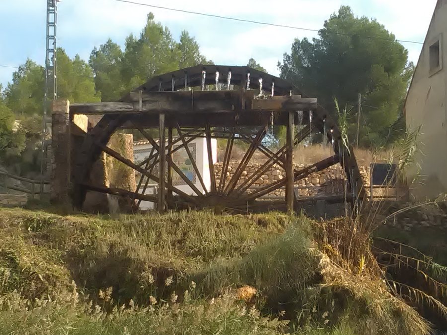
Casas Del Río combines historical landmarks with cycling, hiking and the Cabriel landscape. The Noria de Casas del Río was built in the 18th century. The waterwheel’s historical significance stands alongside paths, riverbanks and elevations as a distinct way of experiencing Casas Del Río.
Historical Traces in the Wider Surroundings
The wider regional surroundings of Casas Del Río include the historic site of Cuevas De La Villa, Ayora Castle, the Church of El Salvador and the Parish Church of San Nicolás de Requena. The present-day Church of El Salvador is designed in the Neoclassical style, has a rectangular floor plan and three side chapels inside.
The Church of Saint Anthony of Padua dates back to a hermitage built in 1766 and dedicated to Saint Anthony of Padua. The waterwheel and Saint Anthony of Padua thus represent two different historical forms: a structure and a consecrated hermitage.
Routes for Cycling, Forest and River
For cycling, Route 1, “Las aldeas de Basta,” provides a clear framework. It leads to Casas del Río, is 26 kilometres long, runs alongside an exceptionally well-preserved riparian forest and is suitable for cyclists of all ability levels. The fixed distance remains a reliable basis for planning the day: your own pace and planned breaks can be arranged around the 26 kilometres. When planning the route, the 26 kilometres and the exceptionally well-preserved section of riparian forest serve as specific reference points for the day’s schedule. The riparian forest provides a clear landscape reference along the route.
The La Chirrichana route descends through dense pine forests to Casas del Río and crosses the Cabriel. The Cabriel marks the transition from the dense pine forest to the rest of the route and gives the descent a clear spatial reference. Its course combines a forest passage, descent and river crossing. Both routes lead to Casas del Río, but differ in that one features riparian forest, while the other features pine forest, a descent and a river crossing.
The Cabriel as a Landscape
The Cabriel route near Casas del Río includes riparian forests on both riverbanks, Mediterranean woodland and agricultural land in the river floodplain. The floodplain thus alternates between wooded banks, Mediterranean woodland and open agricultural areas.
The section of the Cabriel leading to Casas del Río is used for hiking, canoeing, fishing and rafting. For hikers, the focus is on the section itself; canoeing, fishing and rafting, by contrast, put the use of the Cabriel in the foreground.
Hills and the Regional Horizon
The hills of El Hontanar, Espinazo and El Torcón are located in the surroundings of Casas Del Río. The Martés summit is located in the wider regional surroundings of Casas Del Río. Alongside the river landscape, elevations thus also emerge as independent landscape features.
To the overarching travel overview: Requena.

