
Segart Between Mountain Trails and History
Accommodation in Segart
Segart combines the mountain landscape of the Sierra Calderona with short and longer trails, traces of history and special viewpoints. The town lies in the heart of the Sierra Calderona; around Segart, there are hiking trails that open up different ways of exploring the area. When choosing a hotel in Segart, it is therefore particularly relevant whether you want to focus your trip on the character of the town, a specific route or historical sights.
Hiking Trails with Different Profiles
The GR 10 E02 stage from Segart to Serra is a linear route. It starts at Plaça de l'Ajuntament in Segart and is 9.80 kilometres long. The main course of the GR 10 from Segart follows the old path, climbs through the Barranc del Garbí and overcomes the elevation difference via a quarry to Pla del Garbí next to Puntal de l’Abella.
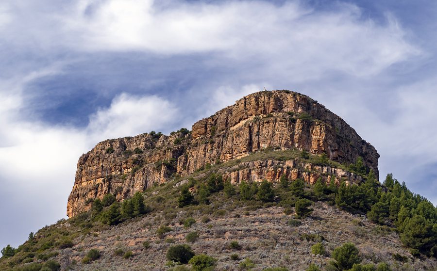
Among the marked trails in Segart is the camino de la Mola. La Mola de Segart is considered the town's most outstanding natural landmark. Another option is the Recorrido por las fuentes de Segart route: it is easy, suitable for all groups and leads to the springs of Segart, with up to nine water points. Font del Salt lies almost on the border between Segart and Nàquera and can form a waterfall during periods of heavy rainfall.
Longer mountain destinations are also part of the region's hiking landscape. The Route of the 6, 7, 8 or 9 Peaks of the Calderona runs through the municipal areas of Albalat dels Tarongers, Segart and Gilet and starts at the Santo Espíritu recreation area. The Ruta de las Cadenas leads from Segart to Mirador del Garbí; the route, just under 3 kilometres long, passes through a rocky pass to the summit of Garbí.
The Canal del Garbí requires precise classification: the section in question is considered a climbing route, not an approved hiking trail. It is not suitable for people without the necessary technical skills and protective equipment. The Calvario de Segart, on the other hand, is considered a recommended hike and is also a viewpoint with panoramic views and a hermitage.
History Along the Town
Segart also offers destinations for a more leisurely exploration of its history. The Iglesia Parroquial de la Purísima Concepción dates from the 18th century. Next to the town hall is Segart's former public washhouse, which can be visited. Font de Jaume is located on the CV-329 access road to Segart; it has been restored.
Castillo de Segart is a fortress of Muslim origin. Remains of the outer walls and the main tower are still visible. These remains indicate that the complex was part of a larger defensive structure. At the end of the Calvario ascent, near Segart cemetery, stands the Ermita de la Santa Creu. The ascent begins near the church square and passes cypress trees and Stations of the Cross with painted tiles.
Traditions Throughout the Year
Segart's Fiestas Mayores include masses, open-air dances, a children's parade and a paella competition. On the final day, a communal pot of arròs amb fesols i naps is prepared for the entire village; a procession also takes place every day. The Fiestas Mayores take place on the last Sunday in July and the first Monday and Tuesday in August. These fixed dates add a special accent if you would like to combine your stay with local traditions.
Other Places in the Region
If you would like to compare Segart with other destinations in the surrounding region, here are some more places: Manises, Beniarjó, Carlet, Torrent, València, Jativa, Fontanars Dels Alforins and Vilamarxant.
For the overarching travel overview: Valencia.

