
Benissili Between Castle History and Mountain Trails
Accommodation in Benissili
Benissili Between Gorges and High Trails
Benissili lies in the eastern part of the Vall de Gallinera at an altitude of around 400 metres and is the highest village in the valley. The village is situated on an almost circular promontory; on its northern side, three gorges merge into a single gorge. This location gives Benissili an unusually distinct geographical character and makes it interesting for travellers who want to experience rural landscapes not merely as a backdrop, but in their structure.
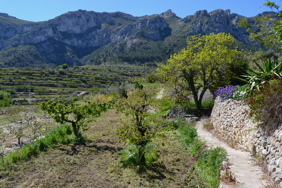 File:Camps al costat del poble de Benissili, la Vall de Gallinera.jpg
Photo: Joanbanjo via Wikimedia Commons, CC BY-SA 4.0
File:Camps al costat del poble de Benissili, la Vall de Gallinera.jpg
Photo: Joanbanjo via Wikimedia Commons, CC BY-SA 4.0
Castle History and Sacred Architecture
Alcalà Castle, usually referred to as Benissili Castle, lies at the entrance to the valley from inland at an altitude of 784.7 metres. During al-Azraq’s first revolt from 1247 to 1258, it was his residence. As a Muslim castle, it follows the usual layout with an albacara, a large courtyard, and a celoquia, the citadel. It is also characterised by its considerable size, complex structure and natural defensive features.
Another architectural detail can be found in the Church of San Pascual Bailón. Its single-nave body has four bays and side chapels. Its features include a barrel vault, transverse arches and Corinthian pilasters. This clear and easily comprehensible spatial layout makes the church a fitting part of a tour through the village’s history.
Route to the Castle and El Xarpolar
The route to Benissili Castle and the Iberian settlement of El Xarpolar is 3.8 kilometres long, reaches an altitude of 890 metres and has a moderate level of difficulty. It begins next to the former school in the upper part of Benissili, leads between centuries-old olive trees to the local road and then continues along a paved section to the fortress. If you plan to take this route, its length and level of difficulty provide a reliable framework for organising your day.
Along the way, the route passes through a stand of large holm oaks and past cherry terraces before reaching the archaeological sites. A side path leads uphill from the spring to the higher slopes, where the Iberian settlement of El Xarpolar is located at an altitude of 902 metres.
Traces of Earlier Village Life
Benissili has several preserved threshing floors: two are located by the cemetery, while another was situated near the spring and washhouse, where there is now a square. On the Route of the 8 Villages, the square with the spring in Benissili is identified as a former threshing floor. The historic Camino Real is also part of the village’s history: it led to Benissili from the north, passed through Calle Major and continued in the direction of the road to Planes.
Cherries from the Vall de Gallinera
In the Vall de Gallinera, early cherries are associated with a special microclimate. It is shaped by mild temperatures, the proximity of the coast and the orientation of the mountains.
Discover More Places
If you would like to explore more places, you can find Polop, Bigastro, Dolores, Benilloba, L'Alguenya, Banyeres De Mariola, Pedreguer and Las Virtudes here.
For the broader travel overview: Alicante.

