
Espadilla: History, Hiking Trails and Springs
Accommodation in Espadilla
Historic Centre with Clear Traces of Time
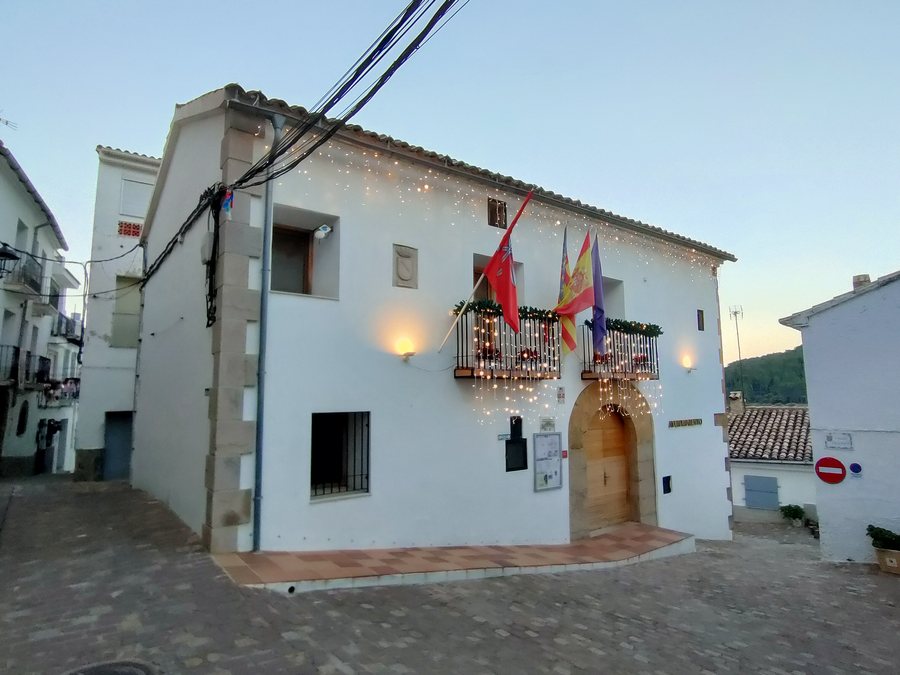
Espadilla reveals its history directly at several notable sites. The traditional historic centre, the Núcleo Histórico Tradicional de Espadilla, has Islamic origins. The parish church Iglesia Parroquial de San Juan Bautista dates from the 18th century. The Casa Abadía provides another historical landmark: the 17th-century building currently houses the town hall. Different eras and present-day functions therefore exist side by side in the townscape.
Fortress, Calvario and Walking Routes
Above the town stands the Castillo de Espadilla, a ruined fortress. Its remaining or recognisable features include walls, the cistern and the remains of a tower. The structure is located just over one kilometre from the town centre and can be reached via a signposted path. It is therefore one of the clearly defined destinations around the town centre for a short cultural excursion.
Religious sites also shape the exploration of the area. The Calvario comprises stations with various depictions of Semana Santa. The Ermita de San Roque can be reached via a short, scenic walk. In addition, Espadilla's botanical garden includes a recreational area. These destinations suit different daily itineraries, without reducing the historical and landscape impressions to a single experience.
The Road as Part of Finding Your Way
From Castellón, Espadilla can be reached via the CV-20. The CV-20 is one of the roads designated as Carreteras Singulares of the Camino del Cid and is the first panoramic road catalogued by the Valencian Community.
Hiking Trails with Different Distances
The circular hiking trail PR-CV 314 begins at C/ Montico 12 in Espadilla and is 9.00 km long. Its route follows the old mule track between Espadilla and Ayódar or passes through the Barranco de la Piqueta below the medieval castle. The two trail sections described provide the hike with a historical and scenic setting.
Another option is the PR-CV 386 Camino a la Cueva Negra. This route is 11.90 km long, with Espadilla serving as the reference municipality. In the direction of Cueva Negra, there is also a route passing between abandoned Masías and trenches from the Spanish Civil War. The surrounding area also has hiking trails, springs, old livestock pens, Masías and lime kilns.
Mountain Ridge, Water and Springs
Peña Saganta reaches an elevation of 723 metres. A tributary of the Río Mijares flows through the municipality of Espadilla. It forms a natural pool used for swimming in summer. The Sastre, Piqueta and Silvia springs are regarded as springs with mineral-medicinal waters. Together, these sites and landscape features form a destination where historical exploration, hiking and observing nature can be balanced.
The planned priorities can influence the choice of accommodation: those mainly planning to visit historic sites and take short walks can focus on the destinations in and near the town centre. For longer hikes, the PR-CV 314 and PR-CV 386, two routes of different lengths, are the main options. Water spots, springs and Peña Saganta provide additional focal points for planning the day.
More Destinations for Trip Planning
Chóvar, Lucena Del Cid, Anroig, Villafranca Del Cid, Sueras, Portell De Morella, Benafer and Sant Jordi
For the overarching travel overview: Castellon.

